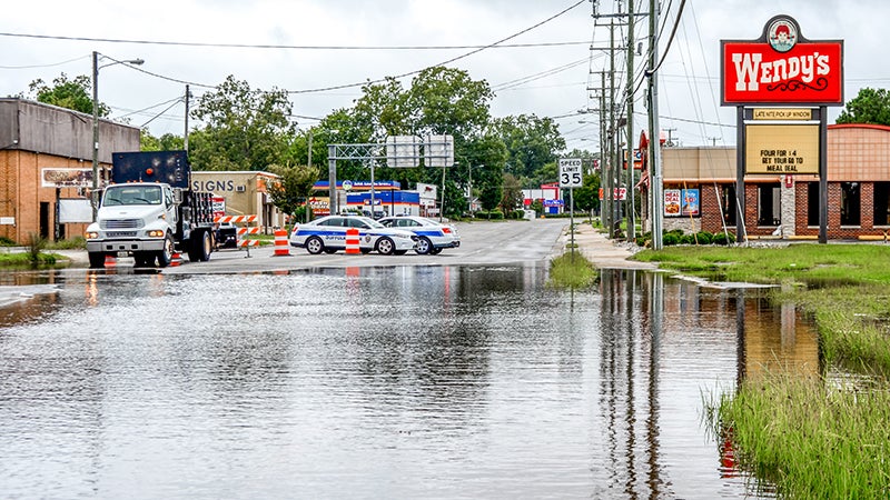
Florence rages forward
Published 9:23 pm Tuesday, September 11, 2018
A federal disaster declaration has been issued ahead of Hurricane Florence’s arrival was approved by President Donald Trump Tuesday, Virginia Gov. Ralph Northam announced.
The declaration allows for the mobilization of federal emergency response assets to prepare hurricane response resources ahead of the storm.
It will also allow Virginia to seek federal reimbursement for the cost of responding to and recovering from the hurricane’s impacts, including storm surges, inland flooding, downed trees and loss of power, according to the press release.
Northam announced a mandatory evacuation at a Monday press conference for Hampton Roads residents in Zone A, which went into effect at 8 a.m. Tuesday. The evacuation order impacts 599 residential addresses and 91 non-residential address, according to a Tuesday press release by City Manager Patrick Roberts. Zone A encompasses a large amount of marsh and wetlands adjacent to the Chuckatuck Creek, Nansemond River, Bennett’s Creek, the tributary adjacent to the River Front and Arbor Meadows communities, Streeter Creek and the James River.
Suffolk will open two emergency shelters for residents at 8 p.m. on Wednesday. The shelters are King’s Fork High School at 351 Kings Fork Road and Nansemond River High School at 3301 Nansemond Parkway.
These shelters are both in response to Northam’s evacuation order for Zone A and in anticipation of a possible evacuation of Zone B.
“To reiterate, emergency shelters should be considered a means of last resort once all other safe options have been exhausted,” Roberts stated in the press release. “If you aren’t in an evacuation zone, you are not expected to need to evacuate, but it’s still important to prepare so that you can shelter in place.”
According to the 5 p.m. update on Friday by the National Hurricane Center, Florence is mostly remaining on its previously reported track with only minor shifts to the west. But all global and regional models are indicating that steering currents will collapse by the end of Friday, when Hurricane Florence approaches the Southeast coast.
This combined with “weak steering currents” that are expected to continue throughout the weekend make the weekend forecast track “quite uncertain,” according to the update.
A motion toward the west-northwest and northwest is expected through early Thursday, the National Hurricane Center reports, and Florence is expected to slow down “considerably” by late Thursday evening and into Friday morning.
Florence is forecasted to move over the southwestern Atlantic Ocean between Bermuda and the Bahamas through Wednesday and approach the hurricane warning area on the coast of North Carolina or South Carolina on Thursday and Friday.
Florence is a Category 4 hurricane that’s expected to strengthen from Tuesday evening into Wednesday. While some weakening is expected on Thursday, the National Hurricane Center reports, Florence is still forecast to be “extremely dangerous” with hurricane-force winds that extend outward up to 60 miles from Florence’s center and tropical-storm-force winds extending outward up to 175 miles.
The National Hurricane Center reports that Florence is expected to produce total rainfall accumulations of 15 to 25 inches with isolated maximum amounts of 35 inches across parts of North Carolina, South Carolina and the mid-Atlantic states from later this week and into early next week. This rainfall would produce catastrophic flash flooding and significant river flooding.
“Winds are expected to first reach tropical storm strength on Thursday, making outside preparations difficult or dangerous,” the National Hurricane Center reports. “Preparations to protect life and property should be rushed to completion.”
National Weather Service Meteorologist Mike Rusnak said the storm is expected to ramp up in Suffolk Thursday evening and Friday morning, when Florence is expected to make landfall on the coast. He said that the forecast for Suffolk has improved, because the storm is expected to stall on the North Carolina coast.
“It’s still going to be 5 to 8 inches of rain potentially, but not like the 15 inches it looked like yesterday,” he said for Suffolk’s forecast.
Suffolk City Offices will be closed Thursday and Friday, and all city facilities will be closed through Sunday. Tours and scheduled special events have been canceled.
Suffolk Public Schools will be closed for staff and students Wednesday through Friday, and Parks and Recreation’s before and after school programs are canceled starting on Wednesday.
The Suffolk Emergency Operations Call Center can be reached at 514-4570 and is currently staffed 24 hours a day for citizens seeking storm-related information for this weather event. The Suffolk Police Department non-emergency number is 923-2350, and the number for non-emergency, roadway-related issues is 514-7600.
The city of Suffolk has a free emergency and non-emergency notification system. This system will send email updates regarding important information. More information can be accessed via suffolk.onthealert.com.
City updates can also be found on the city’s Facebook page or on Twitter @CityofSuffolk.
Visit VAEmergency.gov/hurricanes for more information from the National Oceanic and Atmospheric Administration and the Virginia Department of Emergency Management that will help you “Make a Kit, Get a Plan, and Stay Informed,”
Visit knowyourzoneva.org to find out if your address falls under an evacuation order.


