Cartographic treasure trove
Published 11:17 pm Thursday, November 8, 2012

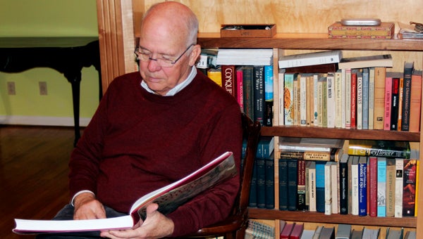
William Wooldridge, a collector of antique Virginia maps who lives in Bennett’s Creek, has produced a book chronicling the hundreds of rare maps he collected throughout more than 30 years.
North Suffolk man collects antique maps
A North Suffolk man known as the dean of antique Virginia map collecting got started in the pursuit at a place far from the Old Dominion.
It was 1970, and William C. Wooldridge, now 69, was stationed in Heidelberg, Germany while serving in the U.S. Army, which the young man from Lynchburg had entered straight from college.
He saw a “little map of Virginia” in a store window and decided to buy it for $35. “I bought it more as a souvenir than anything else,” he said at his Bennett’s Creek Landing home.
Over the next year, Wooldridge said, he bought one or two more old maps of the commonwealth, adding, “By the time you get to three, you are hooked, you are addicted.”
By the time Wooldridge finished collecting maps “a couple of years ago,” when he also started pondering how to dispose of it, he had what is credited as the largest private collection of old Virginia maps in existence.
“We were going to sell it through New York dealers who I bought a lot of the maps from over the years, and word got out around here that I was going to sell the collection,” he said.
Half a dozen Hampton Roads businessmen got together, creating a society that purchased the collection in its entirety.
“They bought all the Virginia maps, lock, stock and barrel,” Wooldridge said, “with the idea of keeping it together and eventually donating it to a local institution that could take care of it.”
The former attorney, who in 2000 retired from a long career with railroad Norfolk Southern and its predecessor, declined to say how much the entire 300 maps went for.
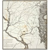
Many from the 19th century can be had for $100 or $200, while a few 17th century maps are worth over $100,000 each, he said.
“The most expensive map I know of that has sold ever was the first to use the name of ‘America,’” he said. “The Library of Congress paid $10 million dollars for that a few years ago. There’s very little that goes over $100,000 dollars.”
Like with all antiques, old, rare maps are only worth big dollars if they’re in demand. “If you want to collect maps of Portugal, you can divide those figures by five or 10,” according to Wooldridge.
Wooldridge has produced a lavish, oversized 392-page book based on the maps he collected throughout 30 years.
“Mapping Virginia: From the Age of Exploration to the Civil War” was launched on Thursday evening at the Mariners’ Museum in Newport News. The Norfolk Historical Society will also premiere the book at 7 p.m. next Wednesday at the Chrysler Museum, a free event where Wooldridge will speak and sign copies.
Published by the University of Virginia Press and with 355 illustrations, 196 in color, “Mapping Virginia” was required of Wooldridge as part of the collection sale terms.
It involves a detailed, gripping narrative explaining the story of each map, which he says offers, due to the unique source material, a history of the commonwealth unlike any other.
“Many of them (the maps) are just remarkably beautiful as art,” he said. “The great century of classic map making was the 17th century, when the Dutch were the primary publishers. This was the age of Rembrandt; they just generated gorgeous maps, and they’re very visually appealing.”


